Geosystems Hellas transforms space data into geospatial intelligence
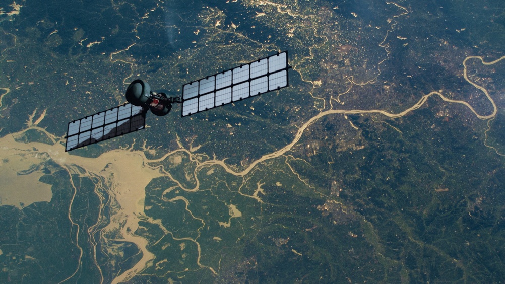
Geosystems Hellas connects artificial intelligence with Earth observation, geopositioning and timing, delivering operational products that support decision-makers in Greece, Cyprus and across Europe
Geosystems Hellas S.A. is a leading Greek company dedicated to providing geospatial intelligence and advanced software solutions that empower clients to make informed decisions and succeed in their missions. The company operates at the intersection of Earth observation, (EO), remote sensing, GIS, smart mapping, Positioning, Navigation and Timing (PNT), and artificial intelligence (AI)-powered spatial analytics, helping organisations transform complex spatial data into trusted operational intelligence.
In the era of New Space, our mission is to transform space data into trusted geospatial operational intelligence. By connecting space assets, Earth observation, Positioning, Navigation and Timing (PNT), and GEOAI with user-focused solutions, we help authorities, organisations and businesses understand complex risks, act earlier and make more confident decisions for defence, security, resilience and sustainable development.”
Betty Charalampopoulou
CEO, Geosystems Hellas S.A.
In a world shaped by geopolitical conflict and rapidly evolving environmental and security risks, access to fast and accurate information has become essential. By fusing data from multi-orbit constellations with complementary databases and AI tools, Geosystems Hellas transforms pixels into intelligence for ISR-intelligence surveillance and reconnaissance. Key capabilities include maritime and border surveillance, dark-vessel detection, maritime activity monitoring, tracking in remote areas, critical-infrastructure mapping, active conflict and disaster-zone monitoring, and population-displacement analysis.

Wildfires, floods and climate-related pressures likewise require decision-makers to understand what is happening across large areas, often under time pressure and with limited ground information. Geosystems Hellas supports this need by combining advanced geospatial technologies with domain knowledge and user-focused service design.
As an authorised reseller of OCTAVE in Greece and Cyprus, Geosystems Hellas combines global innovation with strong local expertise to support public- and private-sector organisations with reliable, mission-driven geospatial solutions. Its services are tailored to complex operational needs and support customers that require accurate mapping, monitoring, analytics, reporting and decision-support capabilities. This approach is especially important for users who need not simply data, but clear and actionable information that can be integrated into their workflows.1
The company’s work reflects the growing role of European space technologies in everyday decision-making. The increasing availability of Copernicus data, commercial European satellite missions, New Space capabilities and emerging national satellite missions – including the Greek Microsatellite Programme, in which Geosystems Hellas participates through three contracts – creates major opportunities, but also a practical challenge: satellite data must be transformed into products that users can understand and apply. Geosystems Hellas focuses on this ‘last mile’ of Earth Observation, connecting upstream data access with downstream processing capabilities, including onboard and on-site processing, AI analytics, visualisation and reporting, to support real-world action.2
This user-centred approach is a key competitive strength. Downstream space services become most valuable when they are translated into solutions that answer users’ specific operational questions. For civil-protection teams, this may mean monitoring wildfire evolution or identifying flood exposure. For maritime stakeholders, it may mean detecting vessel activity or assessing congestion and pollution risks. For security and crisis-management actors, it may mean bringing together multiple data sources to understand complex movements, pressures and hazards. For banking, insurance and financial stakeholders, the same intelligence supports exposure assessment, risk management and evidence-based decision-making, ultimately contributing to citizens’ safety and well-being. Geosystems Hellas develops solutions with these practical needs in mind, aiming to reduce complexity and deliver information through easy-to-use interfaces and formats that support planning, decision-making and response.
Its multidisciplinary team works across advanced software development, geospatial analysis, remote sensing, data management and applied research, supporting both commercial services and European-funded innovation projects. This combination enables Geosystems Hellas to bridge scientific capability and operational use while contributing to wider European priorities. The company’s activities demonstrate how space technologies and AI can be connected to real users and real decisions, from local authorities to governments and businesses, supporting national and European technological sovereignty.
Two products derived from projects coordinated by Geosystems Hellas illustrate this direction. The Golden Twins platform demonstrates how multi-mission Earth Observation can support environmental resilience, civil security and maritime situational awareness, while creating value for public authorities, insurers, financial institutions, tourism operators and citizens. The THEIA Platform is developing an operational solution for monitoring forced population displacement and contributes to the Copernicus Security Services. Together, these examples show how Geosystems Hellas transforms space data into intelligence that helps people, organisations and authorities act earlier and with greater confidence.

Golden Twins: From satellite observation to operational intelligence
 Europe’s civil protection, maritime, tourism and insurance sectors are facing a new operational reality: risks are faster, more connected and increasingly difficult to monitor with fragmented tools. Wildfires, flash floods, undocumented vessel movements, port congestion and oil spills can escalate within hours, especially across islands, coastal zones and mainland regions. Raw satellite imagery is not enough: users need fast, trusted and decision-ready intelligence.
Golden Twins (GT) responds with a ready-to-launch Earth Observation platform that turns multi-mission satellite data into actionable information for environmental resilience, civil security and maritime situational awareness. Developed under ESA’s InCubed programme, GT is an integrated operational product, not a collection of disconnected algorithms. It brings data access, AI-driven analytics, service execution, web visualisation, alerts and reporting into one secure environment.
The operational gap: Satellite data must become action
Earth Observation has never been more powerful. Copernicus missions, commercial constellations and emerging Greek national CubeSat and microsatellite missions are increasing the volume, revisit frequency and diversity of available satellite data. The critical challenge remains the ‘last mile’: transforming complex EO inputs into products that municipalities, insurers, tourism operators, maritime users and civil-protection teams can use quickly.
GT was built around this last-mile problem. Users do not need to manage satellite catalogues, sensor-specific preprocessing or model execution. They need answers: Which areas are affected? Which assets are exposed? Is a vessel behaving normally? Is there a potential oil-spill event? GT converts satellite observations into operational outputs that support timely decisions.


One product, three operational service families.
Golden Twins brings together three service families within a single secure web environment.
GTFire supports wildfire preparedness and response through fire danger estimation, fuel type mapping, active and progressive burned-area mapping, and post-fire potential damage assessment.
GTFlood provides flood extent and depth mapping, flood-prone-area analysis, and potential impact assessment for infrastructure, population and critical points.
GTMaritime supports vessel detection, AIS correlation, dark-vessel identification, port congestion indicators, dark-vessel frequency analysis and oil-spill detection.
Together, these services address risks relevant to mainland, island, coastal and maritime environments.
Near-real-time intelligence
A defining strength of GT is its mission-agnostic architecture. No single satellite can guarantee the right observation at the right time. GT is designed to combine Greek national CubeSat and microsatellite missions, Copernicus missions, Copernicus Contributing Missions, and commercial very-high-resolution multispectral and SAR sources.
This flexibility unlocks the platform’s near-real-time potential. Multispectral imagery provides spectral information for fire, flood and visual interpretation, while SAR supports all-weather and day-night monitoring for floods, vessels and oil spills.
From EO processing to user-ready products
GT delivers outputs through a secure web portal where users define an area of interest, select a time window, activate a service, inspect results on an interactive map, receive alerts or status updates, and export geospatial layers and standardised reports.
The result is a direct bridge between satellite observation and operational decision-making. GT transforms advanced EO analytics into maps, overlays, event records, downloadable evidence products, alerts and reports.
The next step in operational Earth observation
The value of Golden Twins lies in bringing AI-driven analytics, multi-mission satellite access and user-oriented delivery into one integrated product. Its ambition is not simply to observe hazards from space, but to help users understand what is happening, where it matters, and what may require action. Its purpose is clear: to help users see earlier, understand faster and act with greater confidence.
THEIA Project: Enhancing Copernicus Security Services – an EU governmental crisis-management hub for forced population displacement5
 Addressing critical challenges such as population displacement caused by conflicts – and exacerbated by climate change, extreme weather events, food shortages and poverty – remains paramount.
THEIA is a 30-month Horizon Europe-funded project (GA 101190051) aiming to enhance the capabilities of the Copernicus Security Services (CSS) through advanced data fusion, Geospatial Artificial Intelligence (GeoAI) and machine learning technologies. By integrating multi-temporal Earth Observation data with non-space datasets and end-user intelligence, THEIA improves situational awareness, detection capabilities, risk assessment and decision-making for CSS Entrusted Entities such as SATCEN, EMSA and Frontex.6
Coordinated by Geosystems Hellas S.A., the THEIA consortium combines complementary expertise in Earth Observation, AI, data fusion, RF and AIS technologies, cybersecurity and operational security applications.

The project is being demonstrated through three use cases covering maritime and border surveillance of migration flows, terrestrial surveillance of population displacement and movement, and population displacement driven by climate change and extreme events.
Addressing security and crisis-monitoring challenges
THEIA addresses critical gaps in current security and emergency-monitoring services while strengthening European independent technologies, promoting interoperability between legacy and New Space systems, and enhancing coordination among EU agencies, Member States and international organisations. Through validation in operational environments, THEIA is developing exploitable add-on services aligned with CSS, contributing to Europe’s capacity to monitor and respond effectively to forced population displacement and related security challenges.
Innovative technologies
THEIA integrates satellite imagery, optical video, RF and AIS data, UAV observations, open-source intelligence and demographic information to support security and crisis-management applications. This multi-source approach strengthens situational awareness, monitoring capabilities and timely decision-making.
Geospatial intelligence at your service.
https://www.octave.com/
https://www.eoportal.org/satellite-missions/gnssp
https://www.esa.int/Applications/Observing_the_Earth/Launch_boosts_European_Earth_monitoring_and_connectivity
https://thegoldentwins.eu/, https://incubed.esa.int/portfolio/the-golden-twins/
https://theia-project.eu/
https://www.copernicus.eu/en/copernicus-services/security
Please Note: This is a Commercial Profile
This article will feature in our upcoming Space Special Focus Publication.
Source link

